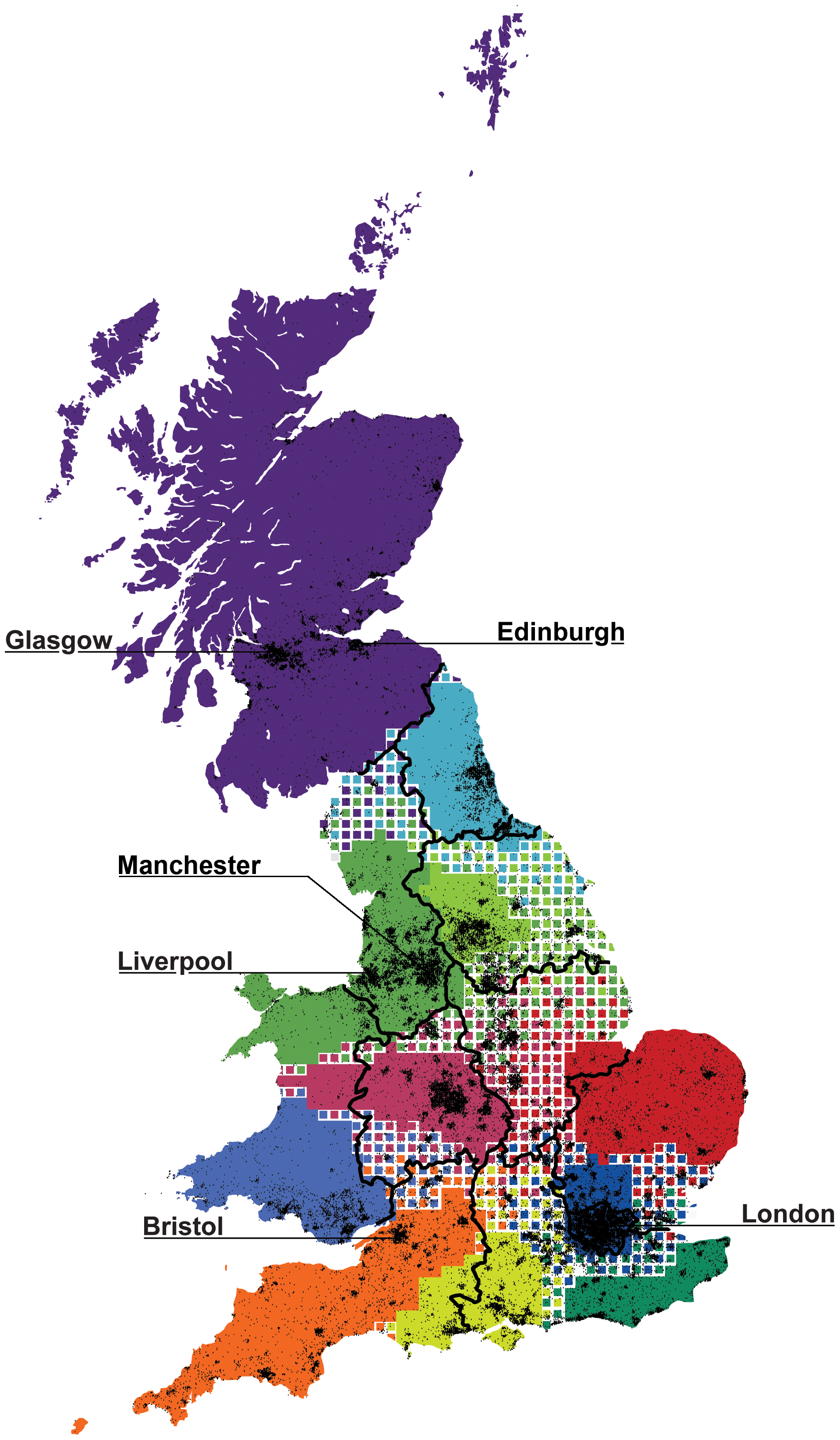
Alternative maps of Britain are an occasional theme. Here’s something really interesting – if it has a regional accent it probably has a genetic signature. Compare and contrast – here’s the map based on BT call-detail records from here.
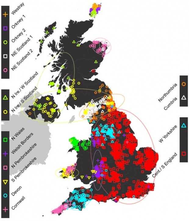
Here’s the genetic one from here:


Saw the new one earlier today and thought of you.
Interesting things shown looking at the two maps map: N and Mid Welsh grumpily migrate to the nearest English town; S Welsh stay in S Wales whilst Cornish & Devonish move to Bristol.
And, most horrifically, there’s no genetic concept of a Yorkshireman…
Oh, but there is. To be honest I’ve never really believed in the Vale of York…
I don’t understand the genetic map at all. Are they suggesting that ‘West Yorkshire’ or ‘South Pembrokeshire’ are ethnicities? I thought the thrust of the study was whether people were from German, Norse, Celtic etc backgrounds? And why are whole areas of the country left barren?
I think they used some sort of clustering algo to pick out markers that are stable over time and linked to geographies – “norse” isn’t a gene, after all.